Kalasa Temple |
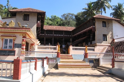
Kalasheshwaraswamy Temple situated at Mudigere taluk, it is a Historical place in India. It stands on bhadra river. sylvan riluation attracted for all devotees and pilgrims forest also one of ablation Area. Scanda puran gives various description in tungabadrakanda , kalasa is considered as Dhakshinakashi. sage Agastya is main cause for kalasa.
Two devotees mitra & varuna were conducting tapas devendra afraid of his tapas devendra sent urvasi a fair lady. Mitra & varuna attracted by fair lady. They respondend by their dance. They spread lust drops in a pot ‘kumba’ Agastya born in kalasa. |
Horanadu Temple |
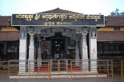
The Annapoorneshwari Temple(Kannada: ಹೊರನಾಡು ಅನ್ನಪೂರ್ಣೆಶ್ವರಿ ದೇವಾಲಯ) is located at Horanadu India 100 km from Chikmagalur in the thick forests and valleys of the Western Ghats of Karnataka. Also called "Sri Kshethra Horanadu", it is situated on the banks of river Bhadra in a remote corner of Chikkamagaluru district of Karnataka, surrounded by the natural vegetation, forest, green lands, and natural beauty of the Western Ghats. This ancient Hindu temple of Goddess Annapoorneshwari has been restored and renamed as the Adi-Shaktyatmaka Shree Annapoorneshwari. The single image is of the Goddess Annapoorneshwari standing on a peeta with Shanku, Chakra, Sri Chakra and Devi Gayathri in her four hands.
Beautiful Arch of Annapoorneshwari Temple The great deity of Adishakthyathmaka Sri Annapoorneshwari's prathistapana was done by His Holiness Agasthya Maharishi several centuries back. The hereditary dharmakartharu of our family started 400 years back. Till the 5th Dharmakartharu, the temple was having a very small structure surrounded by full of natural vegetation and forest. Even then at least one or more people used to visit the temple, have pooja and were provided with free food (annaprasadam) and shelter and it is continued till date. |
Kurinjal Peak |
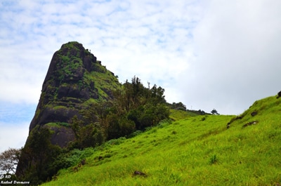
Kurinjal peak in Kudremukh National forest was the first trek in this monsoon. Trekking in Kudremukh area requires permission from forest department and hence I called them few days before to make sure that we will be allowed to trek in the forest. The person on the other side of the phone seemed very polite and supportive. That was good.On Saturday morning I, Krishna and Subbu were at Kudremukh forest Office. The person whom I talked to was not in Office and the guide who was supposed to accompany us was uninterested. The rains and leeches bothered him a lot. But he said that he had no problem in issuing permits if we can manage to trek ourselves.
|
Hanumangundi Falls |
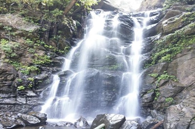
At a distance of 26 Kms from Sringeri & 15 Kms from Kudremukh, Hanuman Gundi Falls (also known as Sutanabbe Falls) is a wonderful waterfall situated close to the main road between Sringeri & Kudremukh. Falling from a height of 100 feet, this is a majestic waterfall located in serene location. There are about 300 well laid steps to reach the falls after little walk from the main road. It is a very safe place to take bath and it's possible to go directly under the falls. Post-monsoon is the best season to visit this falls. The falls is maintained by Forest Dept. and an entry fee is charged at the gate. This place is relatively less crowded.
|
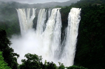
Jog Falls |
Jog Falls, Gerosoppa Falls or Joga Falls (ಜೋಗ ಜಲಪಾತ) is the highest plunge waterfall in India located near Sagara taluk, Shimoga district in the state of Karnataka.[1] It is a segmented waterfall which, depending on rain and season, becomes a plunge waterfall. The falls are a major tourist attraction and is ranked 13th in the world by the waterfall database. They are also known as the Gersoppa Falls or Jogada Gundi. The falls are located on the Uttara Kannada and Sagara border.Jog Falls is created by the Sharavathi River dropping 253 m (830 ft), making it the second-highest plunge waterfall in India after the Nohkalikai Falls with a drop of 335 m (1100 ft) in Meghalaya.
Sharavathi, a river which rises at Ambutirtha, next to Nonabur, in the Thirthahalli taluk and takes the northwesterly course by Fatte petta, receives the Haridravati on the right below Pattaguppe and the Yenne Hole on the left above Barangi. On arriving at the frontier it bends to the west, precipitates itself down the Falls of Gersoppa, and passes that village (properly Geru-Sappe), which is some 29 kilometres (18 mi) distant, discharging into the sea at Honnavar in North Kanara. |
